With the parenting of
National Building Research Institute
NBRI is the designated national focal point for landslide risk management in Sri Lanka. Hence as its responsibilities, NBRI carries out landslide related studies, investigations, mapping, monitoring, early warning and mitigation work and in addition, provides a unique service of issuing Landslide Risk Assessment Reports as a pre-requisite for approving building permits and development plans. NBRI’s expertise extends into a wide range of disciplines such as environmental management, human settlements planning, engineering project management, geotechnical engineering, and building materials engineering.
Latest news
Here are some of the most recent headlines from GeoAi Laboratory at National Building Research Intitute.


Our clients
We provide geospatial solutions and insights to a diverse range of clients, helping them make informed decision

Engineering and Laboratory Services(Pvt) LTD

Kahatagaha Graphit

Waste Management Authority
Road Development Authority
Sri Lanka Railway

Plantation Human Development Trust
Services We Offer
Providing top-quality data acquisition and processing services for detailed terrain modeling and analysis.
LiDAR Data Acquisition & Processing
High-resolution LiDAR point cloud data capture and processing for accurate terrain representation and orthomosaic maps.
Ground Control & Elevation Data Collection
Accurate ground control points and elevation data collection for high-precision mapping and verification.
2D & 3D Mapping Outputs
Delivering high-quality 2D and 3D mapping solutions tailored to your project’s needs and industry standards.
Photogrammetry Survey & 3D Modeling
Utilizing drone-based photogrammetry for terrain reconstruction and 3D modeling for various applications.
SERVICES
Things we’re great at

Training
Businesses in the construction and engineering industry,Agriculture and farming operations,Real estate and property management companies,Infrastructure inspection and maintenance,Media and entertainment industry,Emergency services and disaster management,Energy sector,Transportation and logistics companies andGovernment agencies and municipalities

Remote Sensing
Remote Sensing is the science and technology of obtaining information about objects, areas, or phenomena from a distance, typically using aircraft, satellites, drones, or other sensing technologies. Instead of physically being in contact with the subject, remote sensing captures data using sensors that detect energy reflected or emitted from the Earth’s surface.

Spatial Database Management
Spatial Database Management refers to the storage, retrieval, and management of spatial data, which includes data that represents objects in a geometric space. Spatial databases extend traditional databases by adding spatial data types such as points, lines, and polygons, along with specialized indexing methods that enable efficient querying of spatial data. They are widely used in applications like Geographic Information Systems (GIS), urban planning, remote sensing, and environmental monitoring.

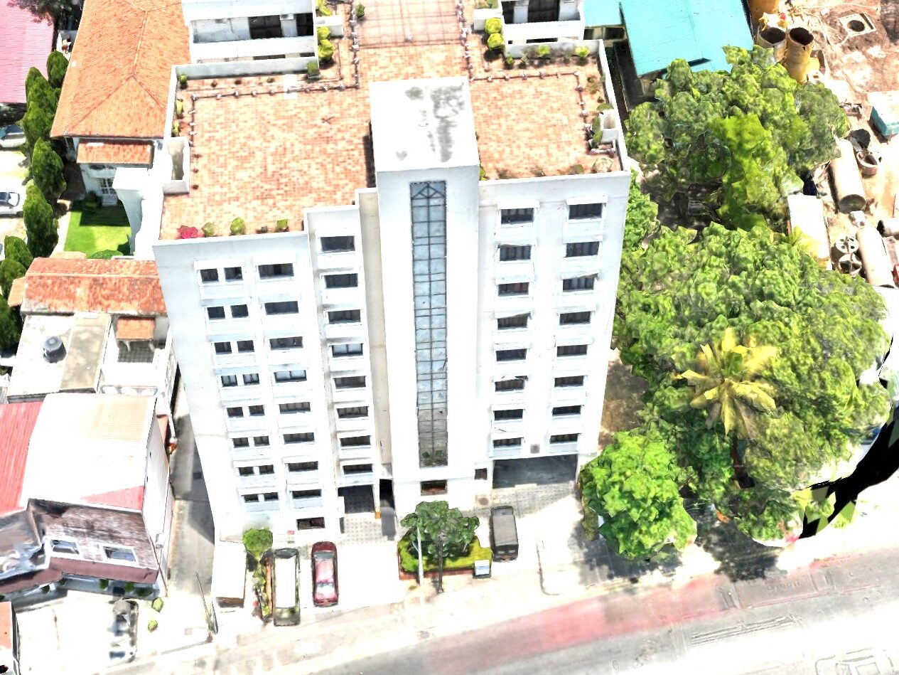
Drone Surveys
The GeoAI Laboratory offers cutting-edge drone survey services that provide high-precision data for a variety of applications. By utilizing advanced drones equipped with RGB, LiDAR, thermal, and multispectral cameras, the lab supports sectors such as urban planning, environmental monitoring, disaster management, agriculture, and construction. These surveys generate detailed 3D maps, monitor vegetation health, assess infrastructure, and track environmental changes, enabling informed decision-making. With applications in forestry,

Land Layout Planning
Land Layout Planning is a crucial process in urban development, ensuring the efficient and sustainable use of land for residential, commercial, and recreational purposes. It involves designing the arrangement of plots, roads, utilities, and public spaces to create functional, aesthetically pleasing, and environmentally friendly layouts. This planning process takes into account factors such as topography, land use regulations, infrastructure, and future growth to optimize the use of available land.

Spatial Data Visualization
Spatial Data Visualization refers to the graphical representation of geographic information and spatial data. It transforms complex data sets into visual formats such as maps, 3D models, charts, and infographics, making it easier to analyze spatial relationships, patterns, and trends. This type of visualization is crucial in fields like urban planning, environmental management, transportation, and disaster management, where spatial data plays a central role in decision-making.
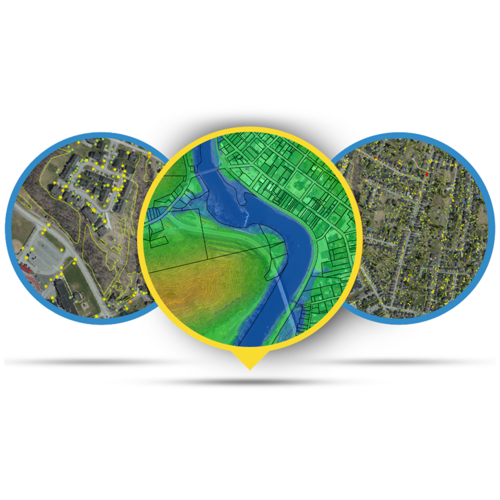
Our Projects
We are pleased to present an overview of our completed projects, showcasing the range and impact of our work. Each project reflects the dedication, expertise, and collaborative efforts of our team, highlighting successful outcomes across diverse initiatives. The following compilation provides a clear summary of these accomplishments, demonstrating our commitment to delivering high-quality results.

Photo Gallery
At GeoAI Laboratory, we have conducted several training and awareness sessions focused on leveraging geospatial technologies and artificial intelligence for real-world applications. These sessions aim to empower participants with the knowledge and skills necessary to integrate cutting-edge tools like remote sensing, GIS, and machine learning into various industries. By fostering hands-on learning and collaboration, we ensure that attendees are equipped to apply these technologies to address complex environmental, urban, and societal challenges.


Comprehensive Training sessions with the field expert
Comprehensive training sessions are conducted by experienced field experts, covering both GIS applications and UAV technologies. The training provides participants with practical knowledge and hands-on experience in spatial data handling, mapping, drone operations, data acquisition, and related field applications.
Portfolio
A Diverse Portfolio of Creative Ventures
Discover a showcase of our finest work. From stunning designs to seamless user experiences, explore how we’ve helped clients like you achieve their goals.
What are you waiting for?
Ready to take the next step? Let’s bring your vision to life! Explore our services and get in touch today for a consultation. Together, we’ll make it happen.
Our Team
Lorem ipsum dolor sit amet, at mei dolore tritani repudiandae. In his nemore temporibus consequuntur, vim ad prima vivendum consetetur.

Chinthaka Rathnasiri
Director(Technical)
Human Settlements Planning & Training Division
Senior Scientist

Danushka Jayathilaka
Senior Scientist

Dayan Munasinghe
Senior Scientist
Sandun Chathuranga
Scientist
Chathumini Samarakoon
Scientist
Shashinika Perera
Scientist
Chathuranga Kumarasiri
Scientist
Contact us
GeoAI Lab specializes in integrating geospatial data with artificial intelligence to drive innovative solutions for urban planning, disaster management, environmental monitoring, and infrastructure development. Our team of experts works on cutting-edge projects involving satellite imagery, drone mapping, LiDAR, and AI-driven spatial analysis.
Experience the thrill of live dealers and immerse yourself in an authentic casino atmosphere with a seamless Pin Up login, bringing the pulse of real-time gaming to your fingertip.
Experience the thrill of live dealers and immerse yourself in a real-time casino atmosphere with the Plinko app to win real money APK, where excitement meets every bet.
Погрузитесь в мир азартных развлечений, где вас ждут тысячи игр: в mostbet uz online представлены топовые слоты и живые дилеры от лучших провайдеров, невероятные бонусы и акции!
Disfruta de la emoción del juego en vivo con nuestros crupieres profesionales, donde el casino topacio te ofrece una atmósfera auténtica con tecnología segura y confiable.
Experience the thrill of real-time casino games with professional live dealers; visit site to immerse yourself in a safe and authentic gaming environment for endless enjoyment.
Hrajte svá oblíbená kasinová hry kdykoliv a kdekoliv díky “Spinboss casino” na vašem mobilu či tabletu, a využijte bohatou nabídku slotů, živých dealerů a atraktivních bonusů.
Discover an unparalleled gaming experience at Glorion casino, where you can enjoy an extensive range of slots, table games, and live dealers from top-tier providers worldwide.
Fedezze fel a izgalmas online szerencsejáték világát, ahol Burancasino lenyűgöző választékot kínál a legjobb nyerőgépekkel és hatalmas jackpotokkal, amelyeken megütheti a főnyerem.
Почувствуйте азарт реального казино с живыми дилерами на Пин Ап, где каждый момент наполнен настоящими эмоциями и динамикой игрового процесса в режиме реального времени.
Pridružite se zabavi s spektakularno ponudbo na Casea, kjer vas čakajo izjemni dobrodošli bonusi, povračila denarja in stalne promocije za dodatne možnosti za zmago!
Experience the thrill of live dealers and the electric casino atmosphere as you check the crazy time live score, making every spin a pulse-pounding moment of excitement.
Otkrijte uzbuđenje online kockanja na dlanu, gdje god se nalazili, dok “Ice Fishing Live” čeka da vas zarazi adrenalinom na vašem pametnom telefonu ili tabletu.
Gioca ovunque ti trovi grazie alla piattaforma mobile di Crazytower, che offre slot, tavoli con croupier dal vivo e bonus esclusivi direttamente sul tuo smartphone o tablet.